At the end of each trip I always record my log and GPS distances. As the log over reads, its no great surprise that the distance covered according to the log is usually more than that produced by the GPS. The one exception to this was the day 65 leg from Lowestoft to Woodbridge.This led me to wonder how much difference does it make to run with the tide. The answer is that the actual distance over the ground was 44nm, but my corrected distance through the water was 36nm. So the movement of the sea carried me 8nm (9.2 miles) and so saved me nearly 2 hours. It gives you some idea how far something might travel down the Norfolk coast if you threw it in the sea.
My total log now reads 1687nm. This would be corrected to 1450nm and my GPSs show 1494nm (1720 miles). This means that overall,so far, the movement of the sea has carried me 44nm (50.6miles) miles), suggesting that by and large I've judged the tides about right.
Non sailing people have asked me.."but doesn't the sea just go in and out?" The answer is no. It sweeps around the coast. This extract from Reeds shows how fast the water travels at the mid point of the tide. The bigger the arrow the stronger the flow. Against the arrow is the speed in knots during both neaps ( smallest) and spring ( greatest) tides.A decimal point is missing between each of the numbers. So off Lowestoft it would be 2.9kn at springs.
Just to extend this navigation lesson a bit further. The under water terrain of the Thames estuary is a series of ridge and furrows radiating out from the main river entrance. This is shown on the extract from the chart. This means that when you wish to cross parts of the estuary you have to cross the ridges, or banks.These banks have names like Foulness Sand,West barrow and long Sand. There are routes across the banks, or channels through, called "gats". Depending on how deep the keel is and what is the state of the tide you plot your route through these openings. It means that if you explore one river you have to go down one furrow and back along it to get out. It can make what looks like a short way on the map, a much longer trip.
I left Brighlingsea late morning and set off for Maldon at the head of the River Blackwater. I was hoping it would be the Essex equivalent of Woodbridge.This is Swallows and Amazons country, so there is an added incentive to explore it.
As I went out into the Coln channel there were a couple of old barges anchored. They seemed to be training ships, because the kids were ashore on the sand bank.
The watch who was left on the boat seemed to be pretty relaxed.Looks a bit like Samba leader Paul. Is he moonlighting?

It was a cracking sail into and down the R. Blackwater. I took this photo by using my camera clamp. It was taken before the wind got up and we started to hum along on a broad reach doing a good 6kns at times (adjusted).
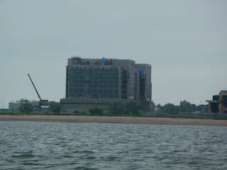
For about 2 hours I was neck and neck with a J21. Those things seem to go pretty well too. We had to dodge between the topper and dinghy races as we went further up the river and past Bradwell power station.
Just after Osea Island the river narrowed and the depth reduced quickly. It was only a bit after low water, so I knew I was going to have to drift up with the tide for the last couple of miles. Sitting firmly on the bottom I was close to the waders in the mud. I put out the anchor and watched the bird life. There were loads of Blacktailed Godwits, Oyster Catchers and Common Terns. Hylje makes a great and very comfortable hide. I cooked up the remains of last night's curry and chilled if that's compatible with a curry.
As i sit here doing the blog I am at Maldon, but there is not enough water. The pontoons are up there and I am down here. The nearest one is a Parker 31 called Paragon. I wonder if he is in the Seal and Parker Owners Association.
It looks an interesting town. The pilot books say the barges on the Hythe are now used for corporate and private charters but at least they are being used.
The news continues to be so depressing.Christian fundamentalist massacre in Norway. Early death of Amy Winehouse.Planning system being picked apart . But at least you've got a few more blogs to look forward to. I went onto Paul Hardaker's one last night. he had set off from Grimsby with Finley but had been driven back by the heavy seas off Spurn Head. These North westerly winds have been really helpful in getting me down the East coast, but it will really slow him up.He's not having much luck.


No comments:
Post a Comment